The Outer Banks… How to Get Here
The Outer Banks is a drive-to destination. Situated just about halfway between the Canadian border with Maine and Key West, Florida, the Outer Banks has become a favorite vacation spot because it’s convenient, but still just remote enough to feel like a getaway.
If you own a private airplane or a boat that can cruise the Intracoastal Waterway, there are other ways to get here. But realistically, the best and easiest way to visit the Outer Banks is to drive.
Obviously, it’s not possible to give directions from every location within a one- or two-day drive, but here are some tips that will certainly help travelers on their journey.
Google Maps does a good job with route planning, and alternate routes are conveniently outlined—especially helpful if traffic becomes an issue.
Driving to the Outer Banks: Major Highways
There are only two highways that link the Outer Banks with the outside world.
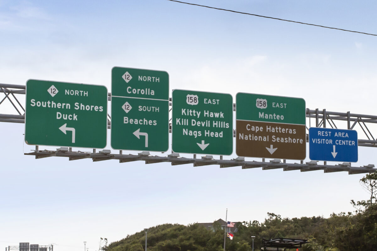
- US 158 enters the Outer Banks from the north at Kitty Hawk via the Wright Memorial Bridge.
- US 64 crosses Croatan Sound linking Roanoke Island and Manteo with the mainland via the Virginia Dare Bridge which, at 5.2 miles long, is the longest bridge in the North Carolina.
Generally, travelers from Virginia and states to the north use the Wright Memorial Bridge, while visitors from North Carolina and states to the south arrive via the Virginia Dare Bridge.
The Wright Memorial Bridge –US 158
US 158 crosses the Wright Memorial Bridge, linking Kitty Hawk on the Outer Banks with Point Harbor on the mainland. Almost all major highways leading to the Outer Banks connect through the Hampton Roads area of Virginia.
The best and most direct option for visitors coming through Virginia is to take Virginia State Route 168, which is a toll road. The highway network in Hampton Roads can be confusing, but GPS usually navigates that very well.
Two major highways connect to Route 168:
-
I-64, for visitors coming from Richmond
-
US 13, through the Delmarva Peninsula, used by many travelers from Philadelphia and New York
Once you’re on Route 168, it’s a straight shot to the Outer Banks. At Moyock, just over the North Carolina border, the road becomes NC 168, which intersects US 158 in Barco—a traffic light, a 7-Eleven, and not much else.
This entire route is a four-lane highway, although expect traffic lights once in North Carolina.
Alternate Route: US 17
US 17 is a possible alternative if traffic is backed up in Virginia. It takes drivers to Elizabeth City, NC, where it intersects with US 158. If traffic on Route 168 in Chesapeake is heavily backed up near the toll road, GPS might reroute you this way.
It’s not the recommended route and will usually take longer, but under certain conditions, it may actually be faster.
Local’s Tip: By a significant margin, most of our visitors use the Wright Memorial Bridge. Because that is the case, from Memorial Day through Labor Day, traffic will sometimes slow to a crawl crossing the bridge on weekends
If at all possible, schedule your arrival time on the Outer Banks before noon or after 5:00 p.m. Saturday is the busier day and has the more significant traffic issues, but on either day expect a delay.
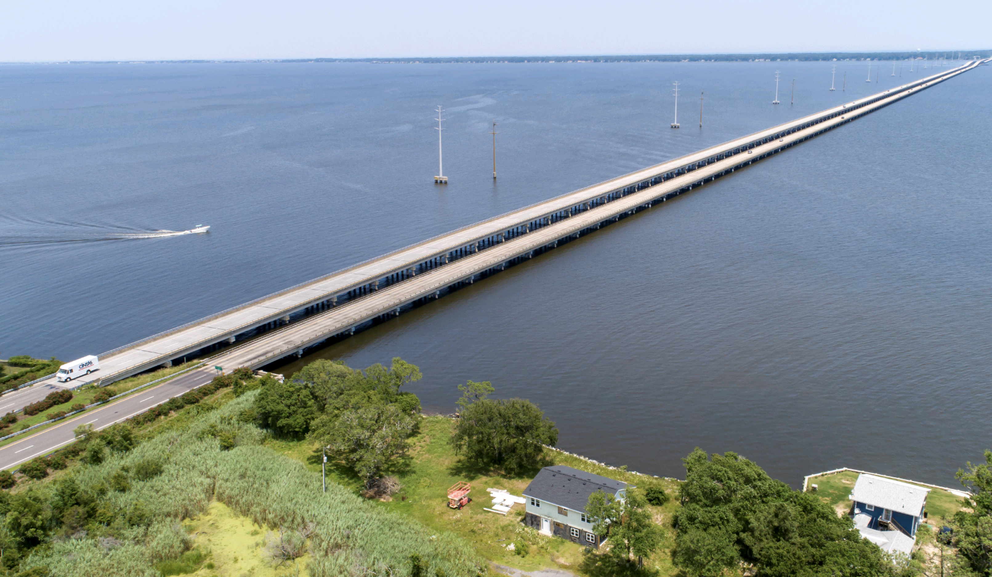
The Virginia Dare Bridge – US 64
Raleigh is the major city where most of our visitors coming from the west and south begin the last leg of their journey to the Outer Banks. US 64 is a four-lane highway from Raleigh to Columbia, NC. About half of that stretch is controlled access, but there are still traffic lights and cross streets in other areas.
After crossing the Scuppernong River at Columbia, the speed limit drops to 35 mph. Upon leaving town, the road becomes a two-lane highway. After crossing the Alligator River, you’ll enter Dare County, the main county of the Outer Banks. From there, it’s still about 46 miles to go, but you’re getting close.
That two-lane stretch passes through the Alligator River National Wildlife Refuge, a 158,000-acre preserve of forest, marsh, and swamp. It’s the second-largest national wildlife refuge on the East Coast.
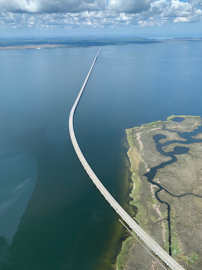
The Virginia Dare Bridge connects the Dare County mainland at Manns Harbor with Roanoke Island. Stay straight at the traffic light after crossing the bridge.
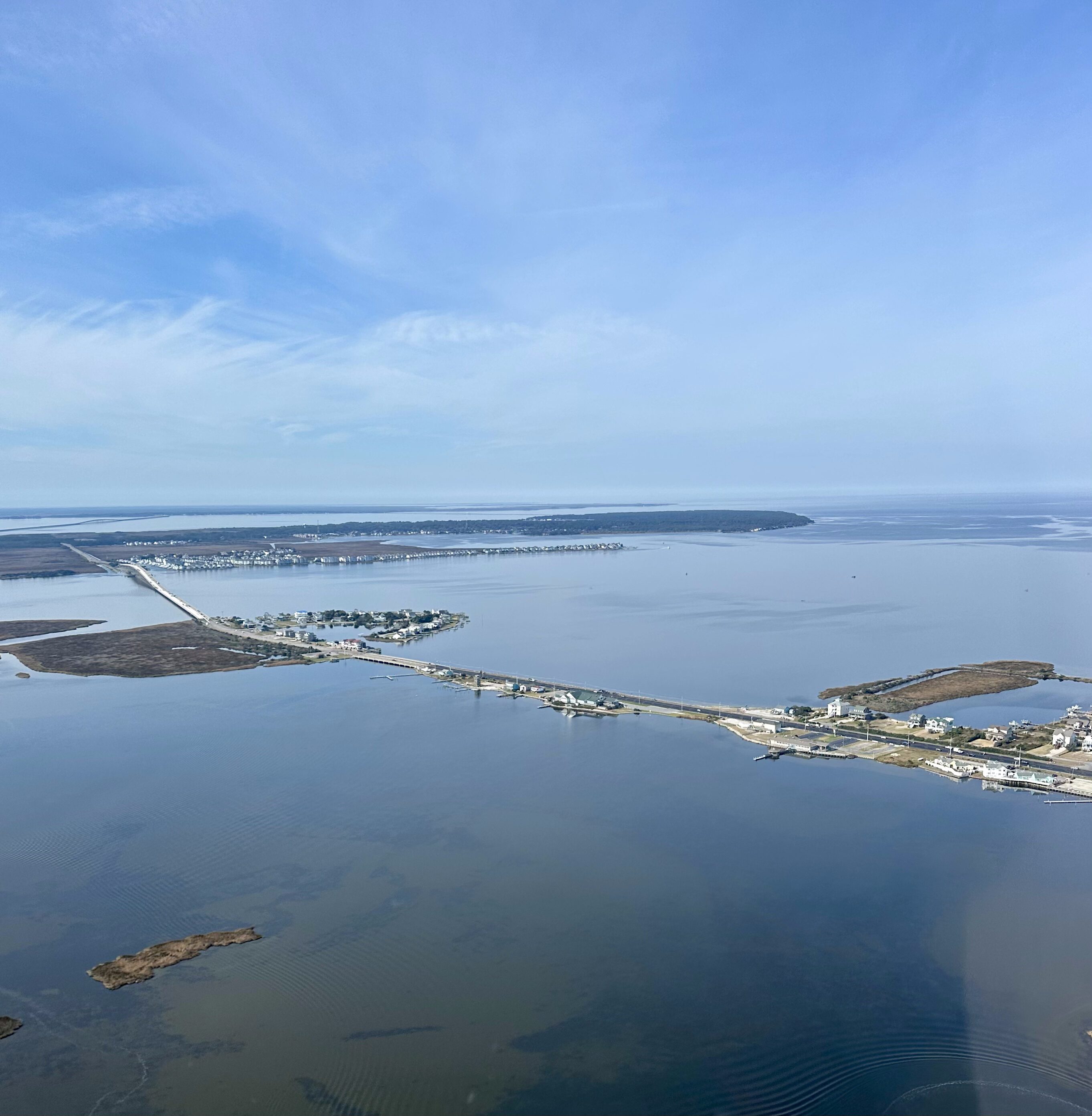
One more bridge remains before officially arriving at the Outer Banks: the Washington Baum Bridge, which brings you into Nags Head.
Alternate: William Umstead Bridge
At the blinking traffic light in Manns Harbor, at the foot of the Virginia Dare Bridge, turning left takes you onto the old US 64, which leads to the William Umstead Bridge. Opened in 1955, it was the first bridge connecting Manteo with mainland North Carolina.
This route exits on the north end of Roanoke Island, requiring a short ride through Manteo to reach the beach.
Local’s Tip One: For the most part, after US 64 heads east from Raleigh, it’s a straight shot. However, when US 17 intersects the highway in Williamston, pay attention to the signs. Accidentally getting on US 17 is certainly going out of your way.
Local’s Tip Two: The speed limit on US 64 from Columbia to Manns Harbor is 55mph. The highway is patrolled. Stay within hailing distance of the speed limit.
Southern Coastal Route – US 264
Although most traffic from the west will use US 64, there’s an alternative for drivers coming from the south.
US 264 begins in Tarboro and winds east to Manns Harbor. It’s a longer, slower route, but if your trip includes Greenville, home of East Carolina University, US 264 may be a good option. It travels through rural North Carolina and generally avoids heavy traffic.
The Ferry: For Travelers with Time on Their Hands
There is another way to get here—and while it’s a lot slower, it can be a relaxing and different start to your Outer Banks vacation.
It is possible to reach the Outer Banks via two ferries.
From the south:
- The Swanquarter Ferry departs from US 264
- The Cedar Island Ferry is part of NC 12, which runs from Corolla to Ocracoke
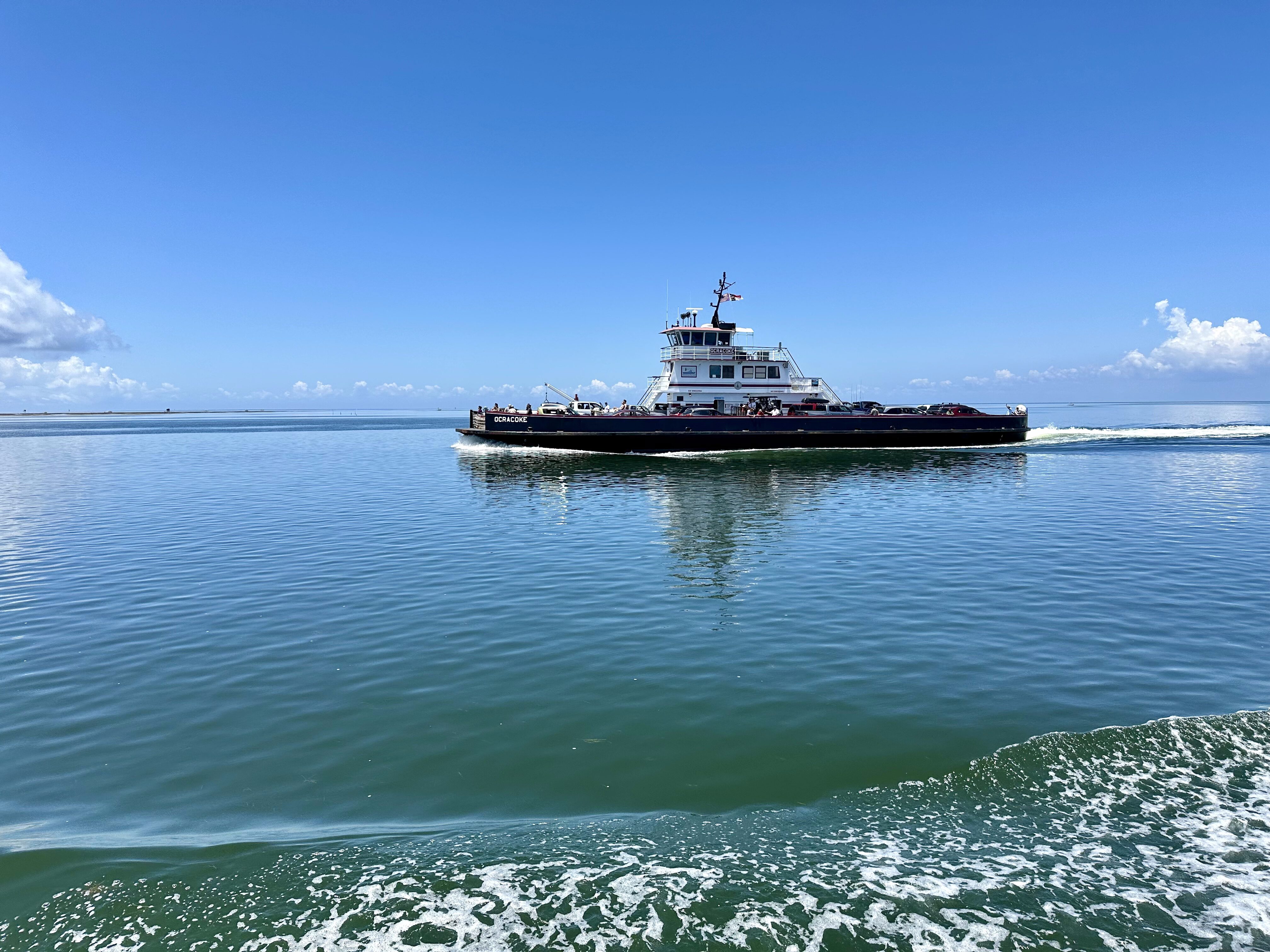
Ocracoke is a charming village worth exploring—but don’t linger too long, because you’ll need to catch a second ferry at the north end of the island.
The Hatteras/Ocracoke Ferry connects you to Hatteras Village, the southernmost village on Hatteras Island. From there, NC 12 continues north through the Outer Banks.
The Swanquarter and Cedar Island ferries are toll ferries, and reservations are strongly recommended during the summer.
The Hatteras/Ocracoke Ferry is free and runs regularly.
Schedule and toll information is available here.
Commercial Flights
There are no commercial flights directly to the Outer Banks, but several airports offer good options.
Most Common Choices:
- Norfolk International Airport (ORF) – Preferred for proximity (1.5-hour drive)
- Richmond International Airport (RIC) – About 3 hours away
- Raleigh-Durham (RDU) – Slightly over 3 hours, often with lower fares
The Newport News/Williamsburg International Airport (PHF) also has scheduled flights, but it’s much smaller than Norfolk.
Planes and Boats
It is possible to fly into the Outer Banks or cruise along the Intracoastal Waterway and arrive by boat. It’s not a common way to get here, but it can be done.
Regional Airports
- Dare County Regional Airport (MQI) – Located on Roanoke Island in Manteo. Two asphalt runways: 4,306 ft and 3,303 ft.
- Currituck County Regional Airport (ONX) – Located in Maple, NC. One asphalt runway: 5,502 ft.
- First Flight Airport (FFA) – Located at the Wright Brothers National Memorial in Kill Devil Hills. One asphalt runway: 3,000 ft.
- Billy Mitchell Airport (HSE) – Located in Hatteras Village. One asphalt runway: 3,002 ft.
- Ocracoke Island Airport (W95) – Located on Ocracoke Island within Cape Hatteras National Seashore. One asphalt runway: 2,998 ft.
Marinas on the Outer Banks
If you’re arriving by boat—or planning to spend some time on the water while you’re here—you’ll be happy to know there are plenty of marinas on the Outer Banks that offer everything from transient slips to full-service facilities. Most are tucked into well-protected harbors with easy access to the sound and the ocean, and some are even within walking distance of restaurants, shops, and attractions.
Roanoke Island and Hatteras Village are home to the largest selections of marinas, and whether you’re docking for a night or staying a while, you’ll find friendly staff, fuel docks, and all the amenities you need for a comfortable stay.
Roanoke Island
- Waterfront Marina (operated by the Town of Manteo)
- Pirate’s Cove Marina
- Shallowbag Bay Marina
- Safe Harbor Outer Banks
Hatteras Village