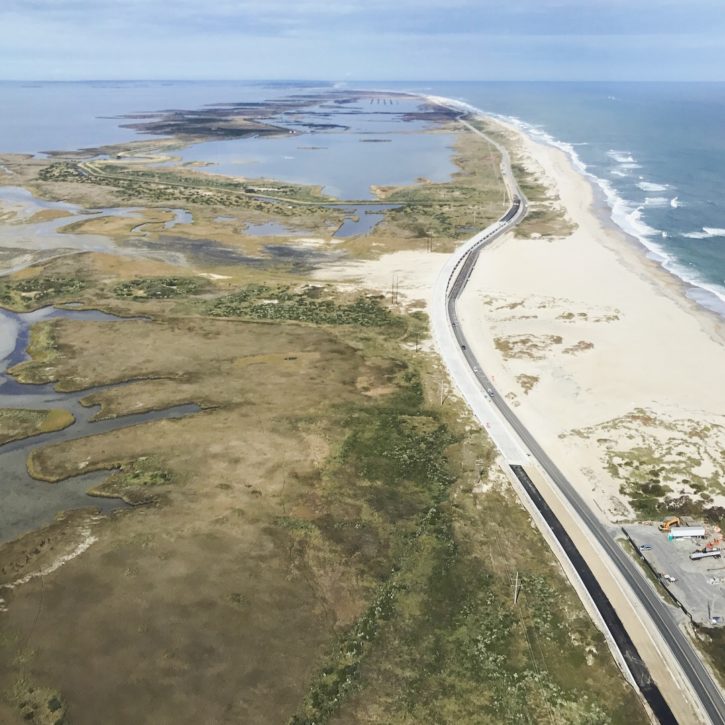
The ride to Hatteras Island as it passes through Pea Island National Wildlife Refuge has a beauty that is not easily described. There are dunes on the seaward side. To the west, Pamlico Sound is a vast open stretch of water but it’s rarely seen from the road. Instead, salt marsh, often held in place by impoundments, and seagrass, come almost to the shoulder of the highway at times.
Depending on the season, the impoundment ponds are filled with migratory waterfowl, but even in the summer, egrets, heron, pelicans, and double-crested cormorants are common.
The shoreline here is extraordinarily dynamic with the ocean constantly overwashing the road or opening and closing inlets. The state has given up trying to keep NC 12 open at the S Curves just north of Rodanthe, and construction on the Jug Handle Bridge that will bypass the area is scheduled for completion in 2021.
Yet the most striking evidence of how mutable the Pea Island shoreline is six miles north of Rodanthe at the Richard Etheridge Bridge, an 1100’ low-slung bridge that seems to pass over dry sand.
In 2011 that stretch of sand was anything but dry as Hurricane Irene breached the dunes and created a new inlet—or perhaps better said, a New New Inlet, for the area is known as New Inlet.
In a section of the Outer Banks known to be in constant flux, New Inlet is one of the most changeable. Since it was first noted on a map in 1657, the area has opened and closed at least four times.
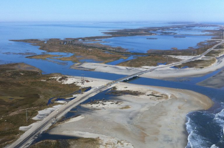
Inlets come and go on the Outer Banks. Pictured is the “New Inlet” in 2011 after Hurricane Irene.
For evidence of the opening and closing of the inlet, look to the west at the skeletal remains of a wooden bridge paralleling NC 12.
One of the longest periods that New Inlet had remained open was from 1738-1922, although it is possible that during that period, the inlet closed and reopened a number of times. We do know, however, from USGS maps from the 1880s, is New Inlet was open at least from the 1880s until it was recorded as closed in 1922.
The area remained dry until a nor’easter in March of 1932 reopened the inlet, creating four channels across the sandbar. The following year, a September hurricane, either Hurricane 12 or 13—NOAA didn’t start naming hurricanes until 1950—made landfall west of Hatteras and tracked across Pamlico Sound as a category 2 storm.
After the storm passed the Coast Guard noted New Inlet was “… made both wider and deeper at some points along the inlet shoreline.”
North Carolina officials believed, with considerable justification, that the new inlet was a boom to Outer Banks fisheries and had no plans to fill the inlet in.
However, residents of Hatteras Island, who had been driving along the beach to take a ferry to the northern Outer Banks and access to the mainland, were now as isolated as they had been 40 or 50 years ago.
Records are unclear about the exact date that construction began but sometime in 1934 or 1935, the North Carolina State Highway and Public Works Commission, the predecessor to NCDOT, began construction on a wooden roadway that would span the entire area of the inlet.
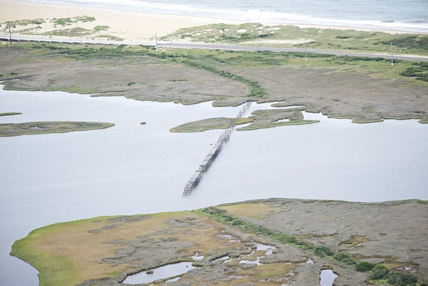
The construction materials and method were wooden trestles with wood bents or pilings. The wood was probably treated with creosote. Properly treated, the wood, even in the harsh environment of the Outer Banks, would reasonably last 25 years.
It would appear as though the roadbed was also wooden, simply planks laid across the width of the bridge. However, it is unclear if that was the case because the wooden planks have deteriorated to the point that it’s difficult to say what their original purpose was.
That a wooden trestle design used is not surprising. Wooden trestle bridges were very common in the United States. When properly constructed, they offered remarkable strength using a fairly lightweight and abundant resource. One of the most common examples of this type of construction is the railroad trestle bridges of the 19th and early 20th century.
Interestingly, there is no evidence that the state constructed any kind of an approach road to the bridge. Evidently, the practice of driving along the beach or among the dunes was so accepted that an approach road was not considered important.
There is no record of how long the bridge was in use. New Inlet had almost closed by 1944 when a hurricane reopened it. By 1950 records indicate it was closed.
After the close of WWII, North Carolina started building a paved road from Hatteras Village to Oregon Inlet. Construction began in Hatteras in 1948 and by 1952 what is now NC12 was paved from Oregon Inlet to Hatteras.