It’s standard knowledge that the Outer Banks is a dynamic strip of sand. Since the 1930’s, it has been largely stabilized by the dunes built by the Works Project Administration, Roosevelt’s initiative to put unemployed Americans to work during the Great Depression.
Yet even with the sand dunes in place and other stabilization efforts, the Outer Banks remains a shifting stretch of sand. A recent example of the fragility of our coastline occurred when an inlet was cut through Hatteras Island in 2011 during Hurricane Irene. That inlet has since closed, but it is a good indication of how active the Outer Banks can be.
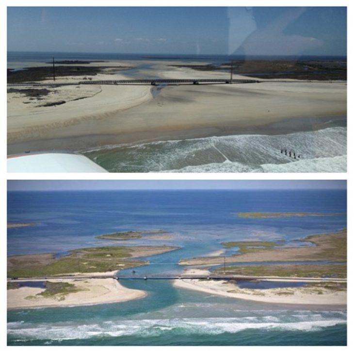
As a side note: although they are called inlets, a more accurate term might be “outlet,” because they are almost always caused by the force of the waters of a bay or sound forcing its way through the dune line. The finger-like shoals that extend into the ocean from an inlet are evidence of that process.
Although there have been no inlets north of Oregon Inlet since it opened in 1846, the northern Outer Banks have a rich history of inlets.
One of the most active and best known was Currituck Inlet.
The inlet has had two locations over time, the first directly across from Knotts Island in what is now Carova, the second about four or five miles south of that.
Soil samples seem to indicate the first Currituck Inlet opened sometime around 1580, and there is evidence that Governor Lane used it to explore the northern Outer Banks when his Lost Colony Expedition was exploring the coast. Reports from the 17th and early 18th centuries indicate the inlet was at one time very wide—perhaps up to a mile, but currents and severe shoaling restricted its use.
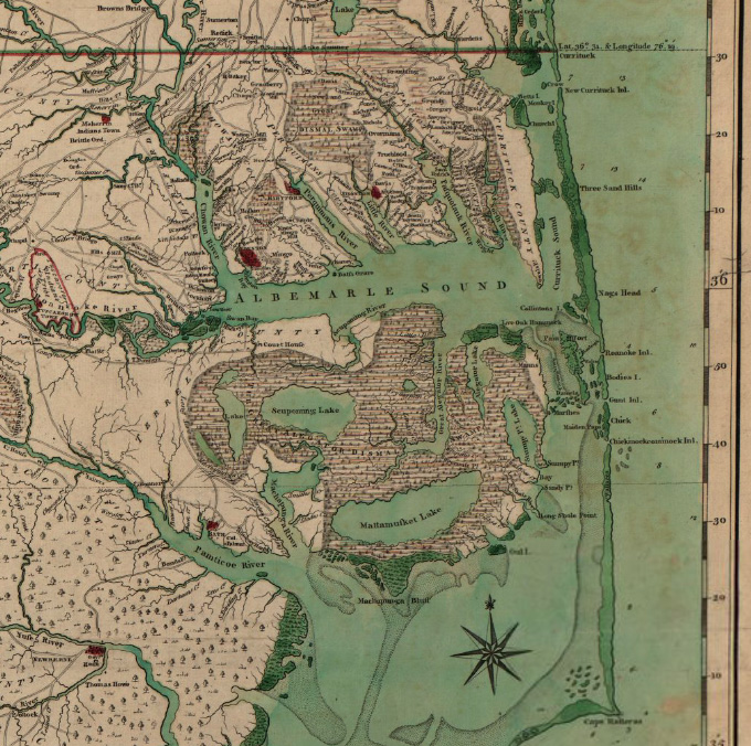
Nonetheless, it was one of the official ports of entry for the North Carolina colony, with ships probably docking at what is today Moyock.
The New Currituck Inlet was formed by a violent storm 1713, according to William Byrd, who wrote both an authorized and unauthorized history of surveying the North Carolina/Virginia state lines.
A well-heeled Virginian, his unauthorized description of the citizens of North Carolina was not kind. “They loiter away their Lives, like Solomon’s Sluggard, with their Arms across, and at the Winding up of the Year scarcely have Bread to eat. To speak the Truth, ’tis a thorough Aversion to Labour, that makes People file off to N. Carolina, where Plenty and a warm Sun confirm them in their Disposition to Laziness for their whole Lives.”
Byrd’s description of his neighbors to the south notwithstanding, Currituck Inlet was actually a fairly important part of early United States maritime trade. As late as 1786, records indicate that some 240 ships docked at the Port of Currituck—Moyock —although by that time the inlet’s importance was waning.
Without constant dredging and stabilization efforts, barrier island inlets invariably shoal up and close, and that was the case for the new Currituck Inlet.
The final blow to the inlet as a port of entry came in 1819 when the US Congress voted to eliminate funding for the Port of Currituck customs house. Six or seven years later, the inlet was completely closed.
The closing Currituck Inlet began a natural process that changed the waters of Currituck Sound from brackish on the south end to fresh on the northern end. That transformation is what created one of the most verdant winter nesting areas for migratory waterfowl in the world.