Which Bridge is Which?
The Outer Banks is not actually attached to the mainland. Well technically, there’s a sandy strip of land linking Carova with Virginia Beach, but that route requires a key to the lock at False Cape State Park that is only available to the original residents of Carova. No key=no entry.
Although it is possible to arrive by boat or aircraft, the way most people get on or off the Outer Banks is via a bridge. It can get confusing, though, if someone says, “The Virginia Dare Bridge is backed up, better take the Umstead Bridge instead.” A statement that could be equally as confusing for residents and visitors, since there is no guarantee everyone knows the names of the bridges.
To alleviate some of that confusion, here is our list of major Outer Banks bridges and their names—with a little additional information about them.
Wright Memorial Bridge
This is the bridge that is the most frequent entry point to the Outer Banks. A twin span, the bridges were built and completed about 20 years apart. Making use of US 158, the bridges link Point Harbor on mainland Currituck County with Kitty Hawk on the Outer Banks.
The bridges are famous—or perhaps, infamous—for their summer weekend backups, although the backups are more a result of traffic control measures on the Outer Banks than the design of the spans.
Historic Notes: There has been a bridge connecting the Currituck Mainland with the Outer Banks since the 1920s. The original bridge was a privately built and maintained wooden toll bridge. Almost resting on the surface of the water, crossing the bridge during storms was a terrifying experience according to those who used it.
Bridge Length: 2.8 miles
Entered Service:
1995 (westbound)
1966 (eastbound)
Lindsay C. Warren Bridge
Also knows as the Alligator River Bridge, because of the body of water it spans, the Lindsay C. Warren Bridge is not actually on the Outer Banks, but we’re including it because it is the fastest and preferred route for anyone coming from the west.
The bridge is one of the oldest serving the Outer Banks, and recently underwent some extensive repairs. It is a drawbridge, but the draw section rotates to let boating traffic through instead of lifting the road.
Historic Notes: First elected to Congress in 1924, Lindsay Warren was a US Representative from eastern North Carolina. He was reelected seven times, but resigned in 1940 when, at the request of President Franklin Roosevelt, he became the comptroller general of the GAO.
Warren was also the author of the Cape Hatteras Seashore Park Bill, creating Cape Hatteras National Seashore.
Bridge Length: 2.8 mi
Completed: 1962
William B. Umstead Bridge
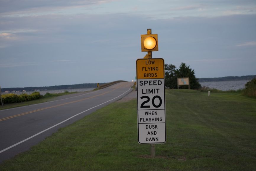
The oldest bridge on the Outer Banks the Umstead Bridge connects Roanoke Island with mainland Dare County, crossing Croatan Sound.
Hard numbers are difficult to come by, but approximately 100,000 purple marlins call the bridge home. In the spring and summer the bridge speed limit is reduced to 20 mph when the marlins are roosting.
Historic Notes: William Umstead was a US Senator and governor of the state. Although he was not from eastern North Carolina, he was the first major politician to advocate for an improved transportation network that included the Outer Banks.
Two days after becoming governor of North Carolina in January of 1953, Umstead suffered a heart attack. He survived, but remained in poor health until he passed away in November of 1954.
Bridge Length: 2.7 miles
Completed: 1955
Virginia Dare Bridge
The longest bridge in the state, this bridge bypasses Manteo and takes the place of the Umstead Bridge.
Historic Notes: The bridge is named for the first English child born in the New World. Born on August 18, 1587 to Anais and Eleanor Dare, Virginia Dare’s fate is as unknown as the fate of the Lost Colony.
Bridge Length: 5.2 mi
Completed: 2002
Washington Baum Bridge
Connecting Manteo with the Outer Banks at Nags Head, the bridge crosses Roanoke Sound. The bridge has a distinctive high arch that is the bane of runners competing in the Outer Banks Marathon.
Historic Notes: Washington Baum was a Wanchese native who was active in Dare County politics and was instrumental in highlighting the transportation needs of the county. He led the fight to get the first bridge connecting Roanoke Island and Nags Head built in 1928.
Bridge Length: 454’
Completed: 1994
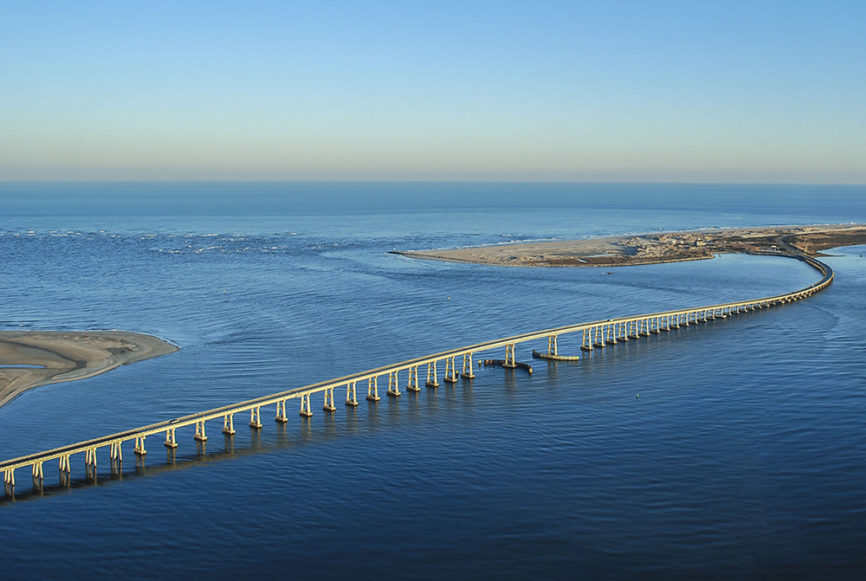
Herbert C. Bonner Bridge
Linking Hatteras Island with the northern Outer Banks—and the rest of the world, the Bonner Bridge crosses Ocracoke Inlet.
Originally designed with a 40 year lifespan, the bridge is well passed it’s age limit. NCDOT has invested considerable time and effort in keeping the bridge safe and open.
A new span is under construction with a scheduled opening date in November of this year. The new bridge is much larger and higher with seven navigation spans instead of one. Design specifications call for the bridge to have a 100 year life expectancy.
Historic Notes: Herbert Bonner served as the US Representative for northeastern North Carolina from 1940 until his death from cancer in 1965.
Bridge Length: 2.4 miles
Completed: 1963
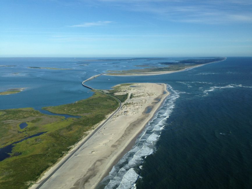
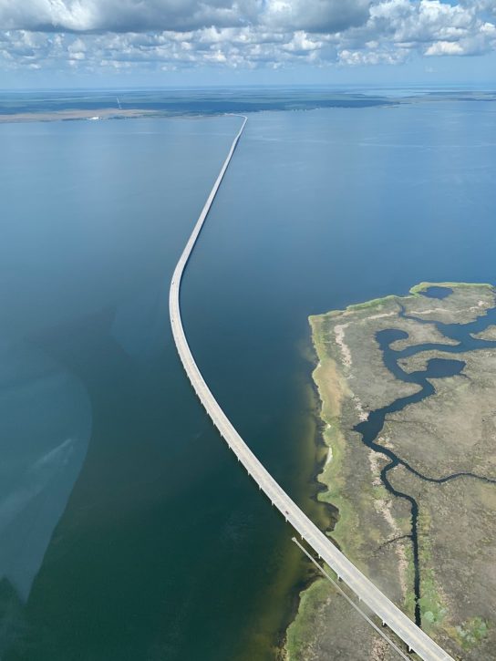
Richard Etheridge Bridge
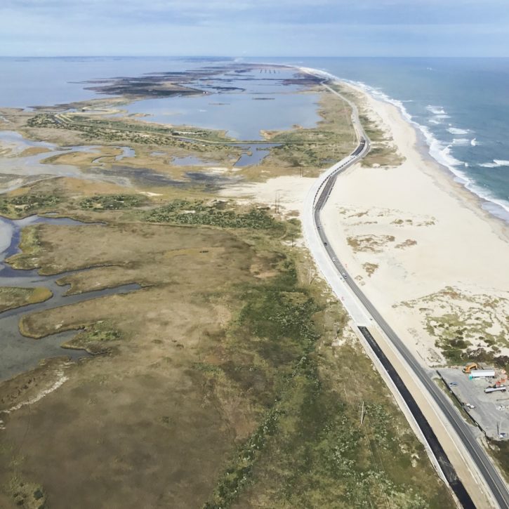
The latest named bridge on the Outer Banks, The Richard Etheridge Bridge spans the New Inlet area on Pea Island north of Rodanthe. Although it has an air of permanence about it, the bridge is not considered a permanent solution and has been engineered to an expected 25 year lifespan. All other Pea Island bridges are being engineered to 100 year lifespans.
Historic Notes: The bridge is a fitting tribute to a remarkable man.
Born a slave in 1842 on Roanoke Island, Richard Etheridge enlisted in the Union Army after being freed ultimately rising to the equivalent rank of Master Sergeant—the highest rank achievable to an African-American at that time. Returning to Roanoke Island he eventually became the Station Master of Pea Island Lifesaving Station #17, the only all African-American manned station.
The rescue of the schooner E.S. Newman on October 11, 1896 by the Pea Island crew exhibited extraordinary courage and skill. It took 100 years for the act to be fully recognized, but in 1996 the crew’s descendants were awarded the Gold Lifesaving Medal.
The bridge is adjacent to the location of Pea Island Lifesaving Station #17.
Bridge Length: 1100’
Completed: 2018
UPDATE 4-2-19
Marc Basnight Bridge Opens over Oregon Inlet
The Marc Basnight Bridge spanning Oregon Inlet opened in April 2019. The bridge is huge and much bigger than the old span. Using materials and engineering concepts that were not even available in 1963 when the Bonner Bridge was built, this bridge has a design life of 100 years, 70 years longer than the planned life of the original span.
“It took 100 engineers who worked on this project to work on this design,” NCDOT Secretary Jim Trogdon said in his remarks at the ribbon cutting. “If you take all the piles that have been used and placed end to end it would stretch 16 miles. It is 3550’ long, with the highest level navigation span and the third longest segmental box girder in North America.”
Update 7-28-22
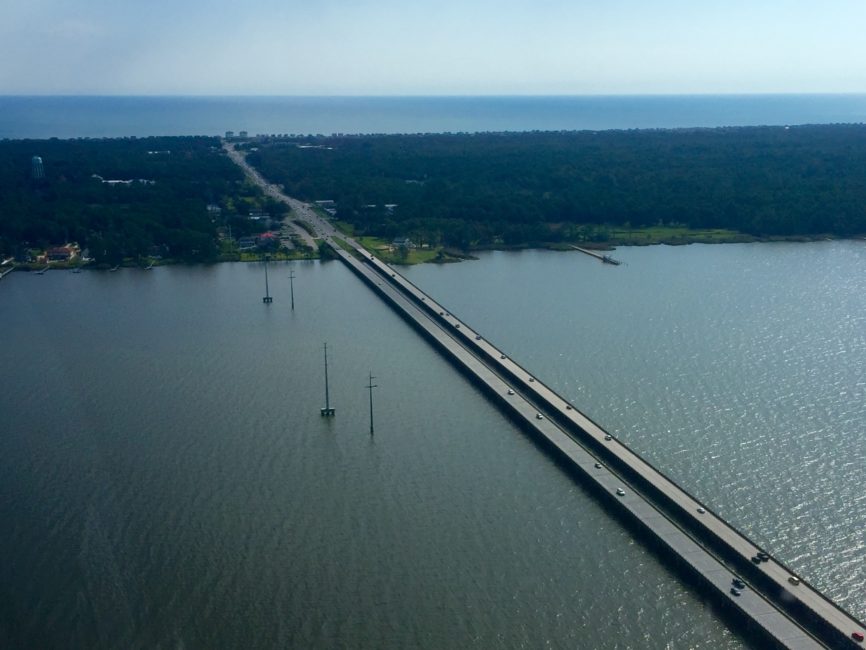
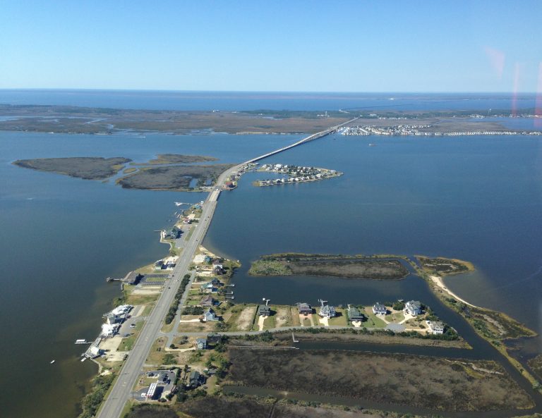
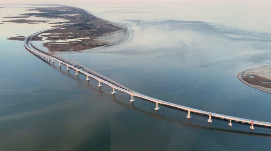
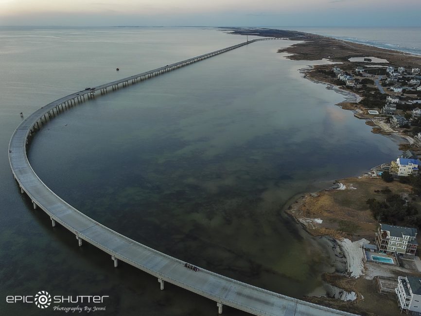
Rodanthe “Jug Handle” Bridge
The Jug Handle Bridge on Pea Island opened to traffic on 7/28/22. Building the bridge was expensive—$154 million—but ultimately, it was the only solution that made any sense. Keeping NC12 open through the S Curves just north of Rodanthe was becoming more difficult and expensive, and every time the highway was washed out, or sand covered the road, Hatteras Island residents and visitors were effectively isolated with minimal options to get on and off the island.
A 100-year bridge, it’s designed to withstand the forces of nature for 100 years. There will, of course, be maintenance that will have to be done, but throughout its lifespan, having the Jug Handle Bridge in place will cost less than continually trying to salvage a land route along one of the most active beaches on the Outer Banks.
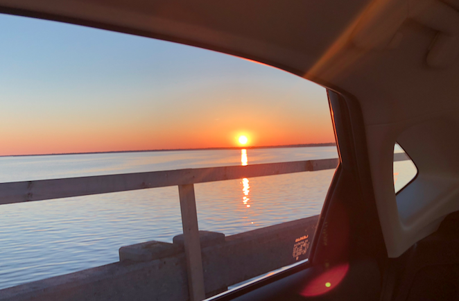
Driving south, the view is to the west, and the endless expanse of Pamlico Sound is awe-inspiring. There’s nothing to see, really, because it’s all water. This is the largest sound on the east coast, and the nearest land is probably a little-known spot of beach sticking out into Pamlico Sound called Sandy Beach. It’s about 14 miles west of the bridge.
At the south end of the bridge in Rodanthe, there is a traffic pattern found nowhere else on the Outer Banks—a roundabout or traffic circle. There was real skepticism when the concept first found its way into the planning documents. It’s still too early to say what will happen over an extended period of heavy traffic, but certainly, in light to moderate traffic, the roundabout works like a dream.
With the bridge acting as a breakwater, the soundside of the north end of Rodanthe seems like a protected cove. Driving north, looking at the waters between the bridge and the shore, there was noticeably less wave action than on the west side of the road.
There is a US Fish & Wildlife parking lot at the north end. It’s a nice parking lot—paved with plenty of parking spaces. There’s a trail that leads out to the beach. It’s a bit of a climb over the dune, but put the effort into it. Right now, the beach it leads to is still an unknown treasure. Wide with soft sand, it is wonderful.