Bonner Bridge Replacement
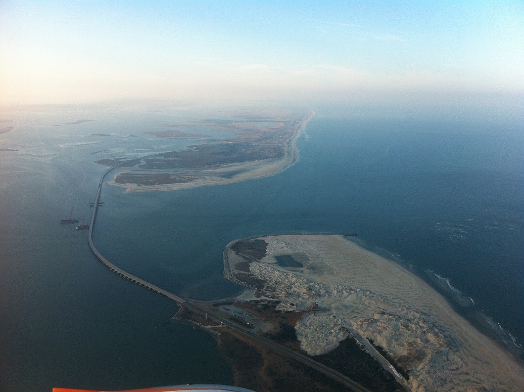 A replacement for the Bonner Bridge, connecting the northern Outer Banks with Hatteras Island, is finally going to be built. Twenty-five years after the bridge’s life expectancy has passed, the North Carolina Department of Transportation (NCDOT) and the Southern Environmental Law Center (SELC) have reached an agreement that will allow a new parallel span to be built just to the west of the existing bridge, and the old bridge will be demolished.
To their credit, NCDOT has done a remarkable job of keeping the existing bridge open, but it is becoming increasingly expensive to do so. With an agreement in hand and sighs of relief all around, construction can finally begin.
The Federal Appellate Court handed NCDOT a partial victory that included a significant legal stumbling block to building the bridge. The case went back to district court with a recommendation that the two sides seek compromise. The negotiations that have emerged allow NCDOT to build the replacement span as originally designed in the 2010 Record of Decision. The SELC raised a concern that plans to build bridges in what would become the surf zone at the S Curves north of Rodanthe and at the breach formed by Hurricane Irene in 2011 were in neither the best interests of NCDOT nor the environment. Those concerns were addressed when NCDOT agreed to a bridge in the sound that would bypass the areas.
There is still some way to go before the new parallel bridge is completed—or construction even begins. PCL Engineering, the design firm for the replacement bridge, stopped work on the project as the court battles raged. One estimate put the completed design work at 80%, but work cannot begin until 100% of the bridge design is completed. Scheduling equipment for the project also came to a halt and, according to NCDOT engineers, that is a significant hurdle to overcome.
Permits also need to be issued. Although much of the work for permits was completed when the court cases began, permits that were issued were suspended to avoid having them expire, and an all-encompassing Coast Guard permit cannot be issued until all other permits are in hand, and there are no court challenges.
The two areas of concern toward the southern half of Pea Island National Wildlife Refuge will involve developing new plans to keep the road open.
Originally NCDOT planned to build bridges designed to withstand the pounding of an active surf zone, high enough over the expected level of the sea that the road would remain open at all times. Maps of the predicted retreat of the shoreline in the areas clearly show that the bridges would be in the ocean in 25-30 years.
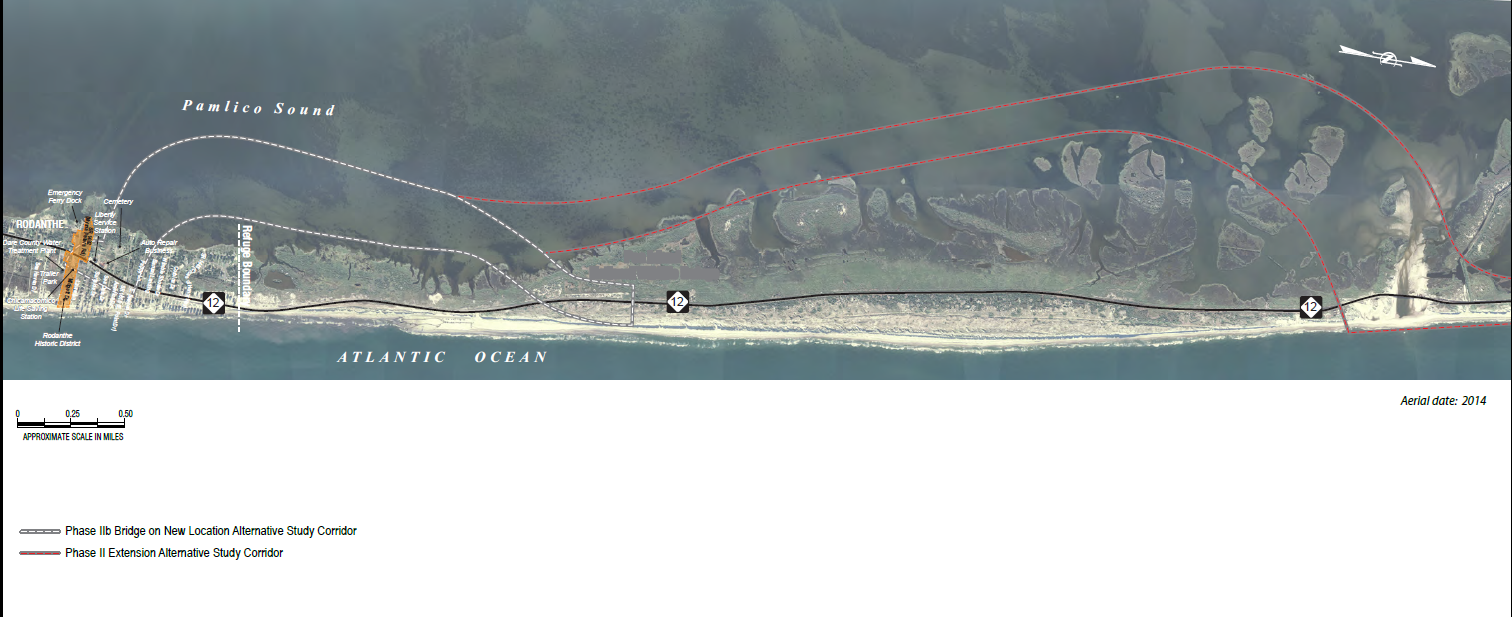
The surf zone bridge concept was favored because the bridges could be built within the existing right of way granted by US Fish and Wildlife (USFW); the SELC felt the spans would damage the environment over time and that it would be safer to bypass the areas completely with bridges placed in the sound.
The first step will be creating a “jug handle” at the S Curves, traversing a short section of marsh and wetlands then bridging a three mile section of Pamlico Sound. The road will intersect with the existing NC12 at the Island Convenience Store in Rodanthe. This configuration will require a new right of way from USFW since a longer bridge will have to be built according to the original plans. However, the bridge will not have to be built to handle the same forces that a bridge in the surf would have to endure.
The area around New Inlet, which is just south of where the Irene breach occurred, is more problematic. NCDOT had already begun a project to build a 2.4 mile long bridge designed to withstand the pounding of the surf. However, that project has been halted. Instead a temporary 3000’ “interim” bridge (that’s NCDOT’s term) will be constructed as a long term solution for the area.
The favored concept at this point calls for taking the road into the Pamlico Sound and constructing a bridge approximately five or six miles in length, depending on which configuration is chosen that would connect with the jug handle bridge.
All parties agree that identifying a long term solution for this area will be difficult. Pamlico Sound by New Inlet is dotted with small islands and is a favored winter nesting site for migratory waterfowl. Any bridge built in this area will involve crossing environmentally fragile zones. Nonetheless, there is, at this point in time, a sense of goodwill among all parties to work toward a solution.